Chicago has long been at the center of city planning, municipal science, and engineering. In 1909, these converged in the lavishly illustrated Plan of Chicago. The Plan changed Chicago so much I would argue that it deserves to be the fifth star on the Chicago flag.
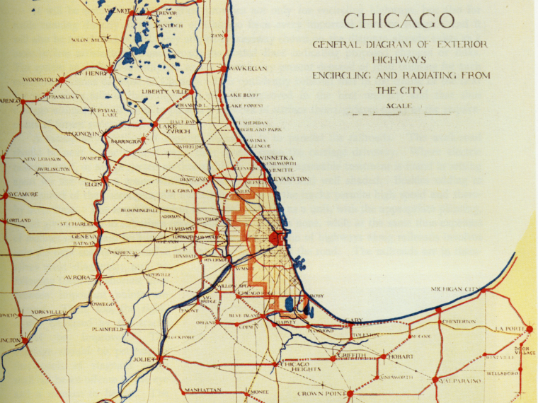
Burnham and Bennett, authors of the Plan of Chicago, looked at other cities and found inspiration in Paris’ earlier plan for transformation, one that took into account the aesthetics as well as practical urban needs – like traffic flow. They noted that London squandered opportunities to create a better city with orderly systems after great conflagrations leveled that city. Chicago would plan its way out of the flaws that were embedded in other cities as they formed.
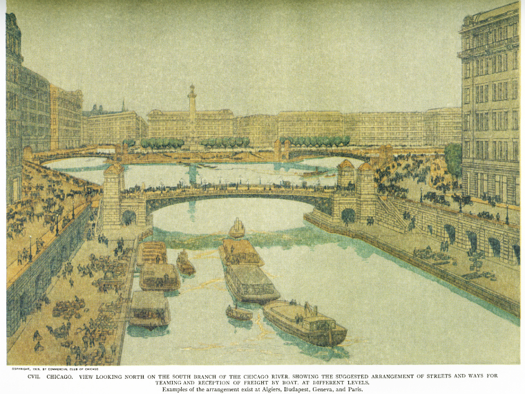
The Plan of Chicago: Daniel Burnham and the Remaking of the American City was a One Book, One Chicago selection. Carl Smith outlines how the Plan’s major changes to the previous systems of roads and boulevards were inspired by the need to eliminate traffic bottlenecks, connect streets spanning the Chicago River, and move traffic around the central business district. These changes were was achieved by many feats of engineering, including developing new bridges, straightening the river, and creating Wacker Drive, a two-tiered roadway, that followed the path of the river.
During its 2009 centennial, the Plan was celebrated by online exhibits such as Without Bounds or Limits: An Online Exhibition of the Plan of Chicago by the Art Institute of Chicago, Make Big Plans: Daniel Burnham's Vision of an American Metropolis by the Newberry Library, and Metro Chicago 2020’s Burnham Plan Centennial Commission
Chicago Public Library has many additional resources on the Plan of Chicago including copies and reprints of the Plan and other original planning documents.

Add a comment to: Make No Little Plans: The 1909 Plan of Chicago