In this age of GPS, having a sense of direction is often a vestigial skill. In some parts of the world, wayfinding is often practiced with regard to mountains – landmarks that you can see and tell if you are going toward, away from or alongside of. Chicago has sometimes been said to be the prairie town that built its own mountain range (the skyscrapers of the Loop). But it is not the tall buildings of the Loop that create the order and sense of direction that make it easy to get around Chicago.
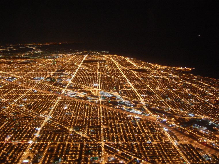
Some of the credit for our grid system of streets is due to the Public Land Survey System. In The Politics of Place: a History of Zoning in Chicago, we learn that Chicago had two great advantages in creating an orderly system of streets and other necessary public works (sewers, refuse collection, etc.). First was the Great Chicago Fire which gave the city a blank slate, and second was the Plan of Chicago – a bold vision for what an ideal, beautiful city could look like. Still another advantage Chicago had was its geography. Chicago’s streets do not have to go around mountains or other features that can interrupt an orderly street grid.
Burnham and Bennett, authors of the Plan of Chicago, devoted an entire chapter to “Streets within a City.” They proposed a number of new ways to move traffic, new thoroughfares along diagonals, and a green beltway of boulevards to connect parks surrounding the Loop.
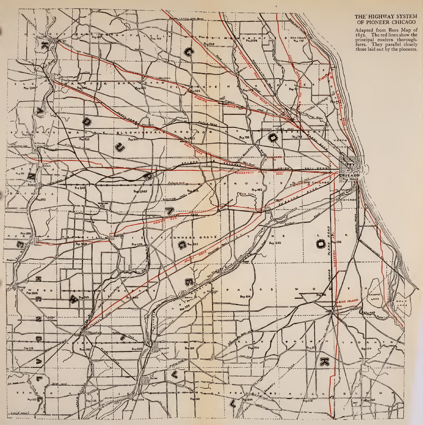
Chicago’s diagonal streets are much older that the Plan of Chicago or even the City of Chicago. According to Milo Quaife, in Chicago's Highways, Old and New, before Europeans set eyes on the dunes and swampland of the future Chicago, these routes were used by Native Americans. These trails connected the expressways of that era— the rivers and lakes—with inland villages along the highest ground.
We owe our current orderly system of street names and numbers to Edward P. Brennan, the subject of my next post.

Add a comment to: From Chaos: Chicago’s Street System