The Federal Government sold and gave away land in farm-sized lots as discussed in the previous post on the Public Land Survey. However a city requires a dense street grid and relatively small lots suitable for building individual residences and businesses.
The process of dividing up the raw acreage into building lots and laying out streets and alleys is called subdivision. The map of each new subdivision is called a plat. Many of the original subdivisions were platted by the Illinois and Michigan Canal Commissioners who were granted approximately half the land in Chicago.
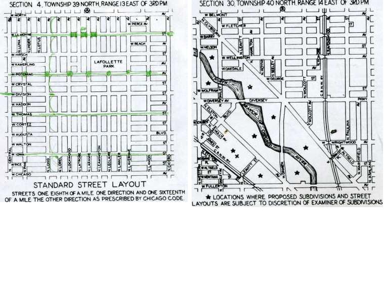
A standard Chicago subdivision has streets laid out eight blocks to the mile in one direction and sixteen blocks to the mile in the other. Each block is numbered and cut through with an H or T-shaped alley. The block is further divided into numbered lots. A typical Chicago lot is 25 feet wide and 125 feet deep. Examples of these standards are shown from the 1938 Official Subdivision and Vacation Guide.
Once a subdivision is approved and recorded, then individual lots can be sold and built upon. Thus subdivision history is an important part of researching neighborhood histories. A good, although confusing, starting point is the City’s 80 acre sheet which shows how each part of the city is laid out.
Of course merely because a subdivision is laid out does not mean that it is built upon. Much of the city was subdivided in the early 1900s, but some parts were not built up until the 1950s. Sometimes, not happy with the original layout, developers resubdivided in order to get larger or smaller lots.
Our historical Sanborn Maps and the historical topographical quadrangles available in our Government Publications Department are useful for tracing the history of a particular neighborhood.


Add a comment to: Subdivisions: Technology That Changed Chicago