According to The World Book Encyclopedia, Chicago “lies on a plain 595 feet (181 meters) above sea level." Different sources measure at different places and give slightly different elevations. As an example, Facts About Chicago uses a Lake Michigan level of 578.5 feet.
Ground level in Chicago ranges from 577 feet at the surface of the Chicago River to approximately 670 feet near 103rd and Western. Lake Michigan, which is generally a few feet higher than the Chicago River, has recently varied from 576 to 582 feet above sea level. Several residential areas along the south lakefront are close to 580 feet—or lake level.
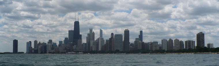
But people live and work at higher and lower elevations. The area around Willis Tower provides a good illustration. The ground level is about 595 feet. The tower’s antenna is 1730 feet . The floor of the lowest basement is 43 feet below ground level. So the tower ranges from 552 to 2325 feet above sea level. Chicago has 7 buildings over 900 feet tall, giving it a mini mountain range 1500 feet above sea level with higher summits.
The Loop is relatively hollow. The first 40 feet underground have basements, sewers, subways and freight tunnels. The subways dip a little lower under the river. So the lowest elevation routinely occupied by people is about 540-550 feet.
300 feet under the river is the Deep Tunnel. It and the water tunnels are bored through the limestone bed rock and have occasional human visitors.
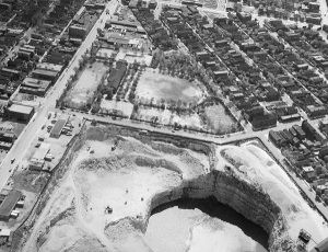
Sterns Quarry in Bridgeport has been filled, but at one time was 380 feet deep. Thus humans in Chicago occasionally work between 200 and 2300 feet above sea level. Wells have been drilled to more than 2000 feet below sea level.
Adding to the mystery, there are at least three different ways to measure elevation in Chicago: the North American Vertical Datum 1988 (NAVD 88), the International Great Lakes Datum 1985 (IGLD85) and the Chicago City Datum. When the level of Lake Michigan is 580 feet on IGLD85, it is about 580.5 feet on NAVD88 and 1.3 feet on the Chicago City Datum.
Historically the NAVD88 has been used for land and the IGLD85 for water. Thus if you are standing on the beach and dip a toe in the water, your wet toe is suddenly six inches lower than your dry toe. The City Datum is used for both land and water.

What is a datum? And why are there three? Datum is the singular of data. This implies a single data point, but really each of these datums are complex models of the shape of the earth based on assumptions about local gravity. Differences in the models and starting points account for contrasting numbers in Chicago.
IGLD88 is used for navigation and water flows on the Great Lakes. NAVD85 is used for mapping the country as a whole. The City Datum is used as a reference point to make sure sewers flow downhill.
The elevation mystery is complicated by the fact that periodically the datums are updated. The ground level in Chicago is rising nearly two feet per century and surveying techniques change. Seven or eight other datums are either used by different agencies or may be encountered historically. Of course Lake Michigan’s water level changes as well.
For more information on elevations and datums, my colleague amkjen has prepared an Elevation in Chicago booklist.

Add a comment to: The Elevation of Chicago: A Statistical Mystery