I am taking a break from “Technology that Changed Chicago,” or at least the title, to do a series of posts on Grant Park.
Grant Park, sometimes known as Chicago’s front yard, is by far the most engineered of Chicago's parks. It has almost entirely been built with landfill in Lake Michigan. Additionally a huge area is used underground. Underneath Grant Park are about 9,000 parking spaces, a music theater, fieldhouses, restrooms, walkways and other facilities.
Although Grant Park: the Evolution of Chicago's Front Yard provides an excellent history, I thought a series on Grant Park was worth doing as it is devilishly hard to sort through the many rare books and documents telling the park's history.
Originally Grant Park was underwater. Michigan Avenue approximately follows the original lakeshore as can be seen in this 1886 map showing Chicago in 1830.
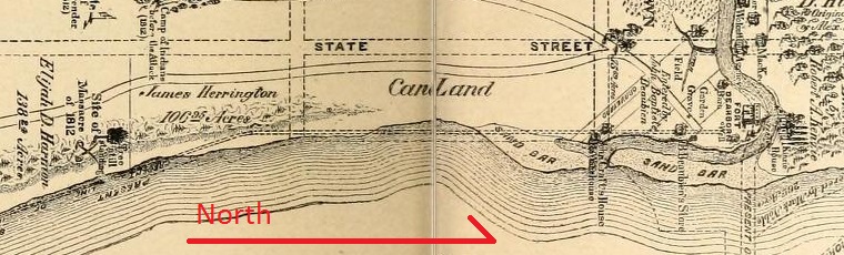
The next map significant to our story was published in 1836 by the Illinois and Michigan Canal Commissioners who owned the lakefront north of Madison. They were subdividing the land and trying to sell it. Their map shows the lakeshore located about 400 feet east of Michigan Avenue.
It is not entirely clear if, or how, 400 feet of the lake got filled. Perhaps the fill came from leveling the sand dunes near Fort Dearborn—or perhaps the Canal Commissioners intended to fill it with earth from the canal they were about to start building. Other sources indicate a smaller area. The 1839 plat of the Fort Dearborn Addition shows Michigan Avenue 66 feet wide with 73 feet of land beyond. At best the area was probably a low sandbar.
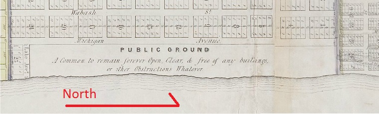
North of Randolph are plots the Commissioners were trying to sell. Between Michigan Avenue, Randolph, the lake and Lake Avenue (a little north of Roosevelt) was a 400 foot by one mile blank space labeled "Public Ground. A Common to remain forever Open, Clear, & free of any buildings, or other Obstructions Whatever." This phrasing became the basis for a number of lawsuits, as well as the classic book Forever Open, Clear, and Free. In 1844 the area became the city-owned Lake Park—also known as Lake Front Park.
Also shown on the 1836 map are the piers extending out from the mouth of the Chicago River. The piers, built in the early 1830s, were supposed to channel water in such a manner that the shallow river would be swept clear of sand, allowing ships to enter. Initially this didn’t work too well so the piers kept on being extended.
If a pier is built out in the lake near Chicago, sand will accumulate on the north side and the south side will erode away. Sand accumulated to the north of the river, ultimately becoming Streeterville. On the south, the 400 feet of lakefill, which may have been imaginary to start with, eroded away.
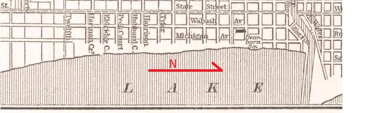
This 1850s map shows the lakeshore back where it started—within 50 feet of Michigan Avenue. Waves were lapping against lakefront mansions.
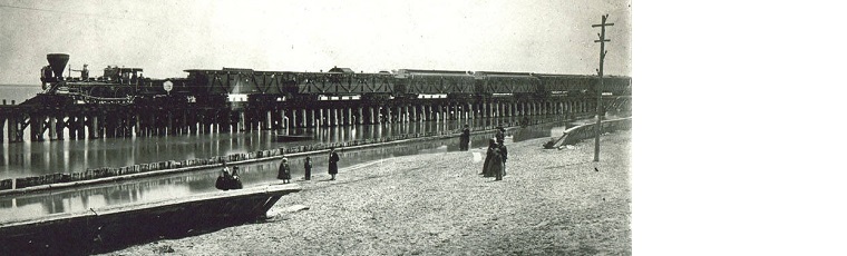
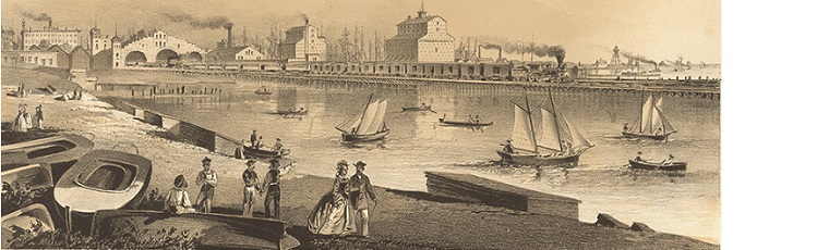
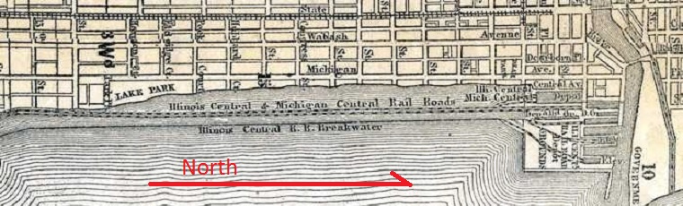
The State of Illinois owned the lakebed. A state law was passed allowing the new Illinois Central Railroad to build out in the lake on the condition the railroad also build a breakwater to protect downtown. In 1852 the Illinois Central built a trestle about 300 feet east of Michigan Avenue and the breakwater a little farther out.
This left a substantial lagoon extending south to 12th street where the railroad came on shore. North of Randolph, the railroad filled in more of the lake and built large freight and passenger depots.
Next: History of Grant Park, 1872-1899
.

Add a comment to: History of Grant Park, 1830-1871